
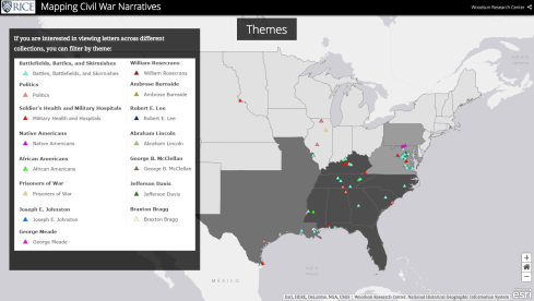
Woodson Research Center is happy to announce Mapping Civil War Narratives, is now available online! Created by Fondren Fellow Christina Regelski, the series of maps uses ArcGIS to highlight some of the Woodson’s numerous Civil War collections (1861-1865). Researchers can now explore the multiple geographies of over 300 Civil War-era letters. From military operations to disease to courtship, these maps convey the potential of our archives’ diverse stories. You can, for example, follow the particular route of a soldier in the Army of the Potomac through his letters or explore the communication in and out of a single city. Use filters to see where men and women were discussing slavery, politics, battles, or military medicine.
Visit the website to take a tour of these maps. Or, if you are familiar with ArcGIS, scroll to the website’s last page to go directly to our two feature maps. View the connections between where letters from each collection were sent and received.
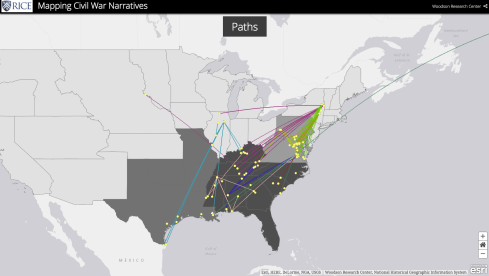
Or look at individual locations to see where letters were written, where they were received, and what locations the authors mentioned within their letters during four years of war. You can explore the collections by mutual themes, as well. See where authors discussed battles, politics, or particular officers.
Part of an ongoing effort under the new Fondren Fellows program, we expect to continue to grow and evolve this project as more of Woodson’s collections are added.
We want to thank Christina Regelski, our Fondren Fellow, for all of her hard work over the fall semester!
Brava! Cool project!